Date: 4/16/2003, 3:35 pm
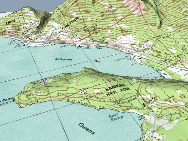
You might want to try playing with some of these toys too, if you want 3D maps. The program 3DEM will create 3D maps from USGS Digital Elevation Maps (DEM). It can also overlay images such as the photos from terraserver or digital topos. 3DEM can also incorporate GPS data and do animated flybys. Obviously an essential kayaking tool!! :-)
3D software - Free
http://www.visualizationsoftware.com/3dem.html
DEM Data - Free, but can be very large to download
http://data.geocomm.com/dem/demdownload.html
Article on using images with 3DEM
http://spatialnews.geocomm.com/features/ikonosdem/
One source of digital topos - Very low res: free
High res: pay for download (very very large!) or CD
http://www.topowest.com/

Messages In This Thread
- Other: Terraserver Maps *LINK*
Chip Sandresky -- 4/16/2003, 9:29 am- Re: Other: Terraserver Maps - Info
Brad Farr -- 4/17/2003, 12:31 am- OT: More toys *Pic*
Bill Price -- 4/16/2003, 3:35 pm- Re: OT: More toys
Dale Frolander -- 4/17/2003, 2:47 am- Re: OT: More toys
Mark Normand -- 4/17/2003, 10:30 am- Re: OT: More toys
Bill Price -- 4/17/2003, 12:12 pm
- Re: OT: More toys
steve hartmann -- 4/17/2003, 8:28 am- Re: OT: More toys
Jeff The Tall -- 4/17/2003, 4:25 pm- Re: OT: More toys *LINK*
Dan G -- 4/17/2003, 10:14 am- Re: OT: More toys
Bill Price -- 4/17/2003, 3:55 pm- Re: OT: More toys
Dan G -- 4/17/2003, 4:25 pm- Thanks Dan! *NM*
Bill Price -- 4/17/2003, 7:31 pm
- Thanks Dan! *NM*
- Re: OT: More toys
- Re: OT: More toys *LINK*
- Re: OT: More toys
- Re: OT: More toys
- GPS and Terraserver Maps
Dan G -- 4/16/2003, 10:39 am- Re: WA Dept of Ecology Shoreline Photos *LINK*
Scott Holmen -- 4/16/2003, 12:21 pm
- Very cool. (But not satellite image) *LINK* *Pic*
Dan Ruff -- 4/16/2003, 9:46 am- California coast photos *LINK*
Severne -- 4/16/2003, 10:56 am- I love the internet
Dan Ruff -- 4/16/2003, 11:25 am
- I love the internet
- OT: More toys *Pic*
- Re: Other: Terraserver Maps - Info


